- Created: August 28, 2012 11:32 am
- Updated: December 12, 2017 11:02 am
- Distance Instructions
- Distance 25 km
- Time 0 s
- Speed 0.0 km/h
- Min altitude 2 m
- Peak 256 m
- Climb 617 m
- Descent 657 m
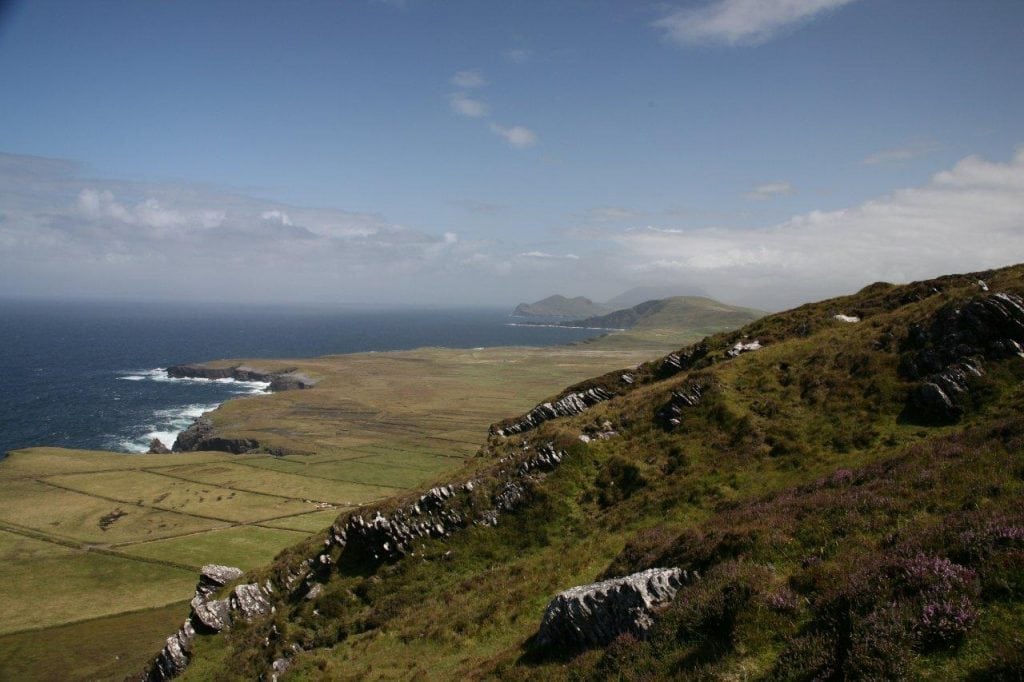
The Valentia Island Head to Toe walk is a moderate to strenuous but extremely rewarding 18km (5 hour) walk the Ferry in Knightstown village to Bray Head, the most westerly point on Valentia Island and a signature Discovery Point on the Wild Atlantic Way. This is one of the Best Walking Routes on the Wild Atlantic Way and Co. Kerry in the south west of Ireland.
This 18km coastal hiking route takes in all the major points of interest and stunning scenery on Valentia Islands northern coastline including:
- From the Ring of Kerry Scenic Drive take the beautiful ferry trip from Renard Point to Valentia Island
- Knightstown Village, Pier and Marina
- The Royal Hotel
- Kingstown Coffee Shop and Second Hand Book Store from 1888
- Altazimuth Stone
- Valentia Island Heritage Centre
- View of Beginish Island, Dolus Head and Knocknadobar Mountain (690m)
- Valentia Island Lighthouse 1841 and Standing Stone
- View of Glanleam Beach
- View of Glanleam House and Subtropical Gardens
- Valentia Island Slate Quarry and Grotto
- View above the 385 million year old Tetrapod fossilised trackway
- Geokaun Mountain and Fogher Cliffs
- Views of Dingle Peninsula and Blasket Islands to the north
- Remains of ancient promontory forts
- Spectacular Culoo Cliffs and Fishing (Extreme Care Advised)
- The Scoilt of Culoo (type of blow hole)
- Poll Gorm or The Blue Pool - Natural Rock Swimming Pool
- St Brendan's Cross and Holy Well
- Paris Cliffs and Coastal Walk
- Bray Head Napoleonic Signal Tower from 1815
- Bray Head WW2 EIRE sign and signal station
- View of the Skellig Islands UNESCO World Heritage Site
- Now a major set location on Star Wars The Force Awakens movie
- Maybe catch a glimpse of a passing Whale below
- Maybe catch a glimpse of migratory seabirds
- Views south to Portmagee, Coomanaspic, the Kerry Cliffs and Puffin Island
- Nearby is the Historic site where the first Trans-Atlantic Cable landed in 1866
- Neary are dry stone buildings from early Christian times
- If the weather permits can visit the Skellig Islands by Boat
- Or visit the Skellig Experience Centre during bad weather
There are plenty of other walking routes in the area, so please find a route that is right for you or your group. Please remember that you are only as fast as the slowest member of your group!
Use our Map of Ireland and Sat Nav tool to get directions to the start point and our detailed maps and GPS on our ActiveME iPhone App and Android App to find and follow the walking route live on screen and keep on track. Remember to like us on Facebook, share your photos and follow us on Twitter. At all times, our maps and App should be used in conjunction with proper map and compass navigation techniques. You are also advised to taking into account the weather and have permission to access the lands where required. Feel free to send us your photos and add you own star rating, comments or suggestions below.
Gallery
The Valentia Island Head to Toe walk is a moderate to strenuous but extremely rewarding 18km (5 hour) walk the Ferry in Knightstown village to Bray Head, the most westerly point on Valentia Island and a signature Discovery Point on the Wild Atlantic Way. This is one of the Best Walking Routes on the Wild Atlantic Way and Co. Kerry in the south west of Ireland.

This 18km coastal hiking route takes in all the major points of interest and stunning scenery on Valentia Islands northern coastline including:
- From the Ring of Kerry Scenic Drive take the beautiful ferry trip from Renard Point to Valentia Island
- Knightstown Village, Pier and Marina
- The Royal Hotel
- Kingstown Coffee Shop and Second Hand Book Store from 1888
- Altazimuth Stone
- Valentia Island Heritage Centre
- View of Beginish Island, Dolus Head and Knocknadobar Mountain (690m)
- Valentia Island Lighthouse 1841 and Standing Stone
- View of Glanleam Beach
- View of Glanleam House and Subtropical Gardens
- Valentia Island Slate Quarry and Grotto
- View above the 385 million year old Tetrapod fossilised trackway
- Geokaun Mountain and Fogher Cliffs
- Views of Dingle Peninsula and Blasket Islands to the north
- Remains of ancient promontory forts
- Spectacular Culoo Cliffs and Fishing (Extreme Care Advised)
- The Scoilt of Culoo (type of blow hole)
- Poll Gorm or The Blue Pool – Natural Rock Swimming Pool
- St Brendan’s Cross and Holy Well
- Paris Cliffs and Coastal Walk
- Bray Head Napoleonic Signal Tower from 1815
- Bray Head WW2 EIRE sign and signal station
- View of the Skellig Islands UNESCO World Heritage Site
- Now a major set location on Star Wars The Force Awakens movie
- Maybe catch a glimpse of a passing Whale below
- Maybe catch a glimpse of migratory seabirds
- Views south to Portmagee, Coomanaspic, the Kerry Cliffs and Puffin Island
- Nearby is the Historic site where the first Trans-Atlantic Cable landed in 1866
- Neary are dry stone buildings from early Christian times
- If the weather permits can visit the Skellig Islands by Boat
- Or visit the Skellig Experience Centre during bad weather
There are plenty of other walking routes in the area, so please find a route that is right for you or your group. Please remember that you are only as fast as the slowest member of your group!
Use our Map of Ireland and Sat Nav tool to get directions to the start point and our detailed maps and GPS on our ActiveME iPhone App and Android App to find and follow the walking route live on screen and keep on track. Remember to like us on Facebook, share your photos and follow us on Twitter. At all times, our maps and App should be used in conjunction with proper map and compass navigation techniques. You are also advised to taking into account the weather and have permission to access the lands where required. Feel free to send us your photos and add you own star rating, comments or suggestions below.


