- Created: January 20, 2014 12:42 pm
- Updated: December 12, 2017 10:58 am
- Distance Instructions
- Distance 14 km
- Time 0 s
- Speed 0.0 km/h
- Min altitude 66 m
- Peak 309 m
- Climb 306 m
- Descent 318 m
2014 KILLARNEY ADVENTURE RACE - St. Patricks Weekend
Register Here: www.stpatricksdayadventurerace.com
Stage 2: Trail Run - 9.5km
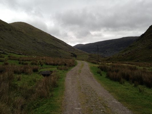
Description:Competitors will drop their bikes and continue by foot along the Kerry way to the remote Black Valley. The check point is at the top of a steep path which leads to a lake at the base of the McGillycuddy Reeks.
Terrain:Walking trail, stone path, forest track, mountain track.
To see the route, use our Map of Ireland and Sat Nav tools on our website and our GPS maps on our free ActiveME App HERE for iPhone and Android to find and follow the route. Feel free to send us your photos and add you own star rating, comments or suggestions below.
2014 KILLARNEY ADVENTURE RACE – St. Patricks Weekend
Register Here: www.stpatricksdayadventurerace.com
Stage 2: Trail Run – 9.5km
Description:Competitors will drop their bikes and continue by foot along the Kerry way to the remote Black Valley. The check point is at the top of a steep path which leads to a lake at the base of the McGillycuddy Reeks.
Terrain:Walking trail, stone path, forest track, mountain track.
To see the route, use our Map of Ireland and Sat Nav tools on our website and our GPS maps on our free ActiveME App HERE for iPhone and Android to find and follow the route. Feel free to send us your photos and add you own star rating, comments or suggestions below.


