- Created: August 28, 2012 10:33 am
- Updated: December 12, 2017 11:01 am
- Distance Instructions
- Distance 26 km
- Time 0 s
- Speed 0.0 km/h
- Min altitude 112 m
- Peak 441 m
- Climb 372 m
- Descent 456 m
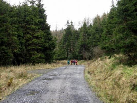
Stage 1 of the Slieve Bloom Way from near Rosenallis to Clonaslee is a moderate 5.5 hour (19.5 km) walking route on the Slieve Bloom Mountains County Laois, Ireland. Starting from Glenbarrow carpark the trail crosses the Barrow River and follows the 350m contour along the wooded slopes of Knockanastumba Mtn (411m). After crossing the Gorragh River, the route decends the wooded slopes of the the Knockachoora Mountain (467m) and finally ending at the village of Clonaslee.
The Slieve Bloom Way is a long distance walking trail in Counties Laois and Offaly, Ireland and is approximately 85 km (52 miles) long. The walking route officially begins and ends in Glenbarrow near the village of Rosenallis, County Laois but you can join the trail at any number of points along its length. The Slieve Bloom Way takes in the the isolated Slieve Bloom Mountains which are full of character, stories and legends. The trail itself is along mostly forestry tracks, tarmac roads, mostly quiet, and paths beside streams and over open moorland, some of which can be wet and muddy. Typically the entire route is broken down into 4 key stages of approximate equal length or duration. You can also break some of these longer stages into smallers part to allow everyone irrespective of fitness or time available to experience one of the best walks in Ireland. There is accommodation available in the towns and villages close to and around the route.
Use our Map of Ireland and Sat Nav tool to get directions to any of the stage start points and our detailed maps and GPS on our ActiveME App to find and follow the walking route live on screen and keep on track. At all times, our maps and App should be used in conjunction proper map and compass navigation techniques.
Gallery
Stage 1 of the Slieve Bloom Way from near Rosenallis to Clonaslee is a moderate 5.5 hour (19.5 km) walking route on the Slieve Bloom Mountains County Laois, Ireland. Starting from Glenbarrow carpark the trail crosses the Barrow River and follows the 350m contour along the wooded slopes of Knockanastumba Mtn (411m). After crossing the Gorragh River, the route decends the wooded slopes of the the Knockachoora Mountain (467m) and finally ending at the village of Clonaslee.
The Slieve Bloom Way is a long distance walking trail in Counties Laois and Offaly, Ireland and is approximately 85 km (52 miles) long. The walking route officially begins and ends in Glenbarrow near the village of Rosenallis, County Laois but you can join the trail at any number of points along its length. The Slieve Bloom Way takes in the the isolated Slieve Bloom Mountains which are full of character, stories and legends. The trail itself is along mostly forestry tracks, tarmac roads, mostly quiet, and paths beside streams and over open moorland, some of which can be wet and muddy. Typically the entire route is broken down into 4 key stages of approximate equal length or duration. You can also break some of these longer stages into smallers part to allow everyone irrespective of fitness or time available to experience one of the best walks in Ireland. There is accommodation available in the towns and villages close to and around the route.
Use our Map of Ireland and Sat Nav tool to get directions to any of the stage start points and our detailed maps and GPS on our ActiveME App to find and follow the walking route live on screen and keep on track. At all times, our maps and App should be used in conjunction proper map and compass navigation techniques.


