- Created: April 10, 2014 11:29 pm
- Updated: December 12, 2017 10:58 am
- Distance Instructions
- Distance 43 km
- Time 0 s
- Speed 0.0 km/h
- Min altitude 0 m
- Peak 126 m
- Climb 223 m
- Descent 256 m
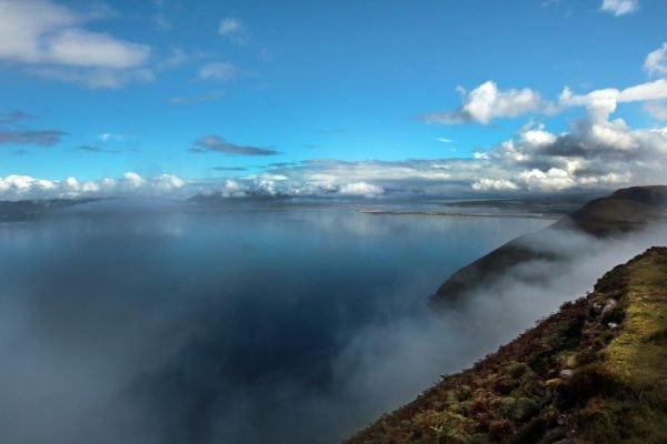
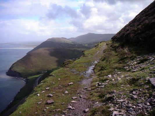
When complete, the now funded coastal Kerry Greenway from Glenbeigh to Cahersiveen and Valentia Island in the south west of Ireland on the Wild Atlantic Way will be one of the worlds best and most spectacular walking and cycling routes . From Glenbeigh, the 30km Kerry Greenway route hugs the side of Drung Hill Mountain over 100m (400ft) above the Atlantic Ocean with spectacular views, passing through tunnels cut into the mountain and also passing over a 70ft high viaduct, along Ireland's Wild Atlantic Way.
View the route map below and on our Free App on iPhone and Android.
The Kerry Greenway follows the old disused railway line which ran from Farranfore to Valentia Island Harbour. Up to the 1960's this rail line was one of the most spectacular train journeys in the world and the western most in Europe. The scenic views of Dingle Bay, Inch and Rossbeigh Beaches and The Blasket Islands on the Mountain Stage section of the line near Glenbeigh are simply out of this world. Take care as some sections of the current Kerry Greenway route are on steep and unstable ground and some require permission to access.
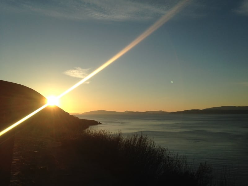
With the recent tourism success of the Great Western Greenway cycle and walking route in Mayo and the Deise Greenway, many other disused railway lines in Ireland are now under consideration for tourism upgrades. Below is a small sample of attractions, side trips and activities on the Kerry Greenway route:
- Glenbeigh is on both the famous Ring of Kerry Drive and Kerry Way Walking Route
- Visit the stunning Rossbeigh Beach for a swim, walk and a
- Seefin Mountain (493m)
- Drung Hill (640m)
- Mountain Stage - the route is perched over 100m above the sea on the side of Drung Hill Mountain
- Scenic Views of Dingle Bay and Peninsula and Inch Beach
- Gleensk Viaduct - built in 1872 it is 175ft long and 70ft high above the Gleensk River
- Kells Bay, Blue Flag Beach and House and Gardens
- Coomasaharn Horseshoe Walking Route
- Knocknadobar Mountain and Ancient Pilgrimage Path
- Coonanna Harbour - beautifully secluded and remote harbour
- Cahersiveen Old Railway Bridge
- Ballycarbery Castle, Cahergal and Leacanabuaile Ancient Stone Forts
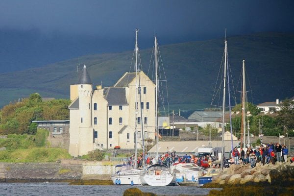
- Cahersiveen Town, Marina and Heritage Centre
- Beentee Mountain and Loop Walk
- Take a ferry to Knightstown on the unmissable Valentia Island
- On Valentia visit the Lighthouse, Tetrapod footprints, Slate Quarry, Geokaun Mtn.,
- On Valentia visit the Bray Head loop walk, Culoo Fishing Cliffs, and Skellig Experience Heritage Centre
- Ask locally for a Ferry to Beginish Island or an evening kayak trip with dinner
- To end your trip don't forget to take a Boat trip to the Skellig Islands UNESCO World Heritage Site
View the Kerry Greenway route map below and on our Free App on iPhone and Android.
When complete, the now funded coastal Kerry Greenway from Glenbeigh to Cahersiveen and Valentia Island in the south west of Ireland on the Wild Atlantic Way will be one of the worlds best and most spectacular walking and cycling routes . From Glenbeigh, the 30km Kerry Greenway route hugs the side of Drung Hill Mountain over 100m (400ft) above the Atlantic Ocean with spectacular views, passing through tunnels cut into the mountain and also passing over a 70ft high viaduct, along Ireland’s Wild Atlantic Way.
View the route map below and on our Free App on iPhone and Android.
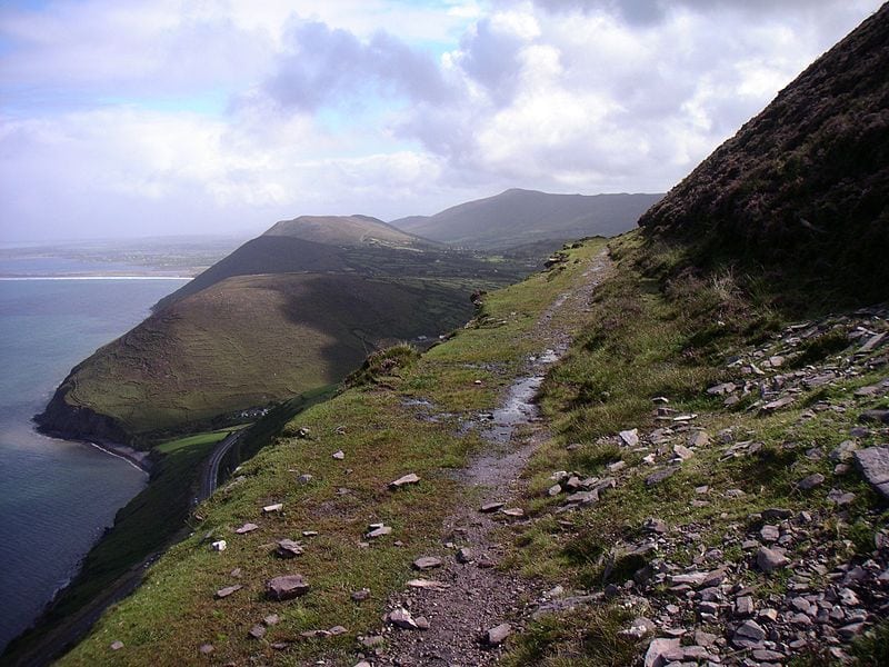
The Kerry Greenway follows the old disused railway line which ran from Farranfore to Valentia Island Harbour. Up to the 1960’s this rail line was one of the most spectacular train journeys in the world and the western most in Europe. The scenic views of Dingle Bay, Inch and Rossbeigh Beaches and The Blasket Islands on the Mountain Stage section of the line near Glenbeigh are simply out of this world. Take care as some sections of the current Kerry Greenway route are on steep and unstable ground and some require permission to access.

With the recent tourism success of the Great Western Greenway cycle and walking route in Mayo and the Deise Greenway, many other disused railway lines in Ireland are now under consideration for tourism upgrades. Below is a small sample of attractions, side trips and activities on the Kerry Greenway route:
- Glenbeigh is on both the famous Ring of Kerry Drive and Kerry Way Walking Route
- Visit the stunning Rossbeigh Beach for a swim, walk and a
- Seefin Mountain (493m)
- Drung Hill (640m)
- Mountain Stage – the route is perched over 100m above the sea on the side of Drung Hill Mountain
- Scenic Views of Dingle Bay and Peninsula and Inch Beach
- Gleensk Viaduct – built in 1872 it is 175ft long and 70ft high above the Gleensk River
- Kells Bay, Blue Flag Beach and House and Gardens
- Coomasaharn Horseshoe Walking Route
- Knocknadobar Mountain and Ancient Pilgrimage Path
- Coonanna Harbour – beautifully secluded and remote harbour
- Cahersiveen Old Railway Bridge
- Ballycarbery Castle, Cahergal and Leacanabuaile Ancient Stone Forts
- Cahersiveen Town, Marina and Heritage Centre
- Beentee Mountain and Loop Walk
- Take a ferry to Knightstown on the unmissable Valentia Island
- On Valentia visit the Lighthouse, Tetrapod footprints, Slate Quarry, Geokaun Mtn.,
- On Valentia visit the Bray Head loop walk, Culoo Fishing Cliffs, and Skellig Experience Heritage Centre
- Ask locally for a Ferry to Beginish Island or an evening kayak trip with dinner
- To end your trip don’t forget to take a Boat trip to the Skellig Islands UNESCO World Heritage Site
View the Kerry Greenway route map below and on our Free App on iPhone and Android.

