- Created: August 28, 2012 10:33 am
- Updated: December 12, 2017 11:01 am
- Distance Instructions
- Distance 13 km
- Time 0 s
- Speed 0.0 km/h
- Min altitude 2 m
- Peak 141 m
- Climb 280 m
- Descent 280 m
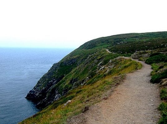
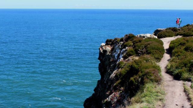
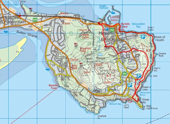
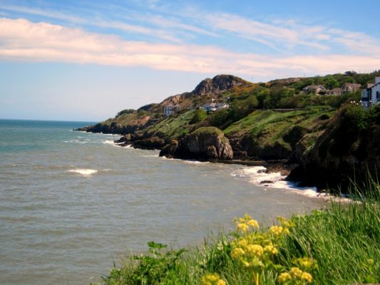
The Howth Cliff Path Loop Walk is a moderate 6 to 10km (2 to 3 hrs) loop walk taking in some easy road walking, rugged but superb cliff walking and great scenery. Only a hop, skip and jump from Dublin City by road or train (Dart), Howth is an idyllic seaside day out from the bustling city and one of the top things to see and o when visiting or living in Dublin. Take this scenic walking route with you on our free App for iPhone and Android and share your photos on the ActiveMe facebook page.
- Places to Stay Near Howth: coming soon
- Places for Food Near Howth: coming soon
- Places for Entertainment Nearby: coming soon
- Local Walking Guide or Tour Guide: coming Soon
- Other greats Things to See and Do in the Area: coming soon
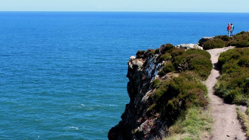
Only a 25mins (approx €6 return) on the DART train from Dublin City, the Howth Cliff Path Loop Walk starts at the DART (train) station in Howth village and follows the green arrows passing the Harbour, Marina and then along the cliff path as you climb to ‘The Summit’. Returning here along a path parallel to the outward route is a 6km loop walk but you can extend the walk to a 10km loop by heading towards the Lighthouse and returning on well worn paths with spectacular views along the entire walk including teh nearby Lambay Island and Ireland’s Eye as well as Dublin Bay, local bird life, seals and other flora and fauna.
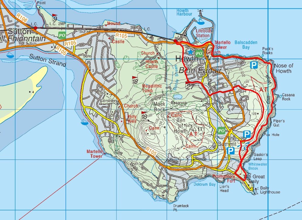
The Howth Cliff Path Loop Walk is one of Irelands best coastal walks and is suitable for all. However, it would be advisable to avoid the path during windy or wet conditions as the narrow cliff path can become slippery and subject to gust of wind. Some interesting stories and facts along the route include:
- The ruins of the 15th-century St Mary’s Abbey where the bells were rung in foggy weather to guide Howth’s fishermen safely home.
- During the 18th century there were many shipwrecks in Dublin Bay and resulting in the construction of Howth harbour in 1807.
- Howths Martello Tower, one of many built around the coasts of Ireland and Britain during the Napoleonic Wars was to protect against invasion by the French.
- Ireland’s Eye island to the north is a bird sanctuary and site of an early Christian monastery
- Beyond Irelands Eye is Lambay Island and on a good day you can see the Mourne Mountains in Co, Down, Northern Ireland
- The Howth Cliff Path Walk passes Balscadden House, home of the young William Butler Yeats.
- To the south you can see the coast of Wicklow and the scenic Bailey Lighthouse built in 1814 and the site of an ancient promontory fort.
- There has been a lighthouse here since the mid 1600's

On the return, the path pleasantly meander until it reaches Balkill Park and onto the the old railway station where in the 12th century the Normans defeated the Vikings of Howth in a bloody battle with great loss of life.
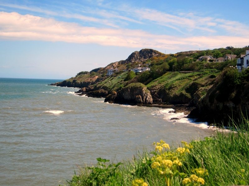
Plan your walk by checking the weather, sunrise sunset times and our hiking checklist on our website https://www.activeme.ie/useful-info/planning-a-trip/. Please remember that you are only as fast as the slowest member of your group! If the weather is poor don't be afraid to cancel your walk and do some other walk, maybe a low level walk.
Use our Map of Ireland and Sat Nav tool to get directions to the start point and our detailed maps and GPS on our ActiveME iPhone App and Android App to find and follow the walking route live on screen and keep on track. At all times, our maps and App should only be used in conjunction with proper map and compass navigation techniques.
Gallery
The Howth Cliff Path Loop Walk is a moderate 6 to 10km (2 to 3 hrs) loop walk taking in some easy road walking, rugged but superb cliff walking and great scenery. Only a hop, skip and jump from Dublin City by road or train (Dart), Howth is an idyllic seaside day out from the bustling city and one of the top things to see and o when visiting or living in Dublin. Take this scenic walking route with you on our free App for iPhone and Android and share your photos on the ActiveMe facebook page.
- Places to Stay Near Howth: coming soon
- Places for Food Near Howth: coming soon
- Places for Entertainment Nearby: coming soon
- Local Walking Guide or Tour Guide: coming Soon
- Other greats Things to See and Do in the Area: coming soon

Only a 25mins (approx €6 return) on the DART train from Dublin City, the Howth Cliff Path Loop Walk starts at the DART (train) station in Howth village and follows the green arrows passing the Harbour, Marina and then along the cliff path as you climb to ‘The Summit’. Returning here along a path parallel to the outward route is a 6km loop walk but you can extend the walk to a 10km loop by heading towards the Lighthouse and returning on well worn paths with spectacular views along the entire walk including teh nearby Lambay Island and Ireland’s Eye as well as Dublin Bay, local bird life, seals and other flora and fauna.

The Howth Cliff Path Loop Walk is one of Irelands best coastal walks and is suitable for all. However, it would be advisable to avoid the path during windy or wet conditions as the narrow cliff path can become slippery and subject to gust of wind. Some interesting stories and facts along the route include:
- The ruins of the 15th-century St Mary’s Abbey where the bells were rung in foggy weather to guide Howth’s fishermen safely home.
- During the 18th century there were many shipwrecks in Dublin Bay and resulting in the construction of Howth harbour in 1807.
- Howths Martello Tower, one of many built around the coasts of Ireland and Britain during the Napoleonic Wars was to protect against invasion by the French.
- Ireland’s Eye island to the north is a bird sanctuary and site of an early Christian monastery
- Beyond Irelands Eye is Lambay Island and on a good day you can see the Mourne Mountains in Co, Down, Northern Ireland
- The Howth Cliff Path Walk passes Balscadden House, home of the young William Butler Yeats.
- To the south you can see the coast of Wicklow and the scenic Bailey Lighthouse built in 1814 and the site of an ancient promontory fort.
- There has been a lighthouse here since the mid 1600’s

On the return, the path pleasantly meander until it reaches Balkill Park and onto the the old railway station where in the 12th century the Normans defeated the Vikings of Howth in a bloody battle with great loss of life.

Plan your walk by checking the weather, sunrise sunset times and our hiking checklist on our website https://www.activeme.ie/useful-info/planning-a-trip/. Please remember that you are only as fast as the slowest member of your group! If the weather is poor don’t be afraid to cancel your walk and do some other walk, maybe a low level walk.
Use our Map of Ireland and Sat Nav tool to get directions to the start point and our detailed maps and GPS on our ActiveME iPhone App and Android App to find and follow the walking route live on screen and keep on track. At all times, our maps and App should only be used in conjunction with proper map and compass navigation techniques.

