- Created: August 28, 2012 11:32 am
- Updated: December 12, 2017 11:02 am
- Distance Instructions
- Distance 8 km
- Time 0 s
- Speed 0.0 km/h
- Min altitude 9 m
- Peak 189 m
- Climb 228 m
- Descent 231 m
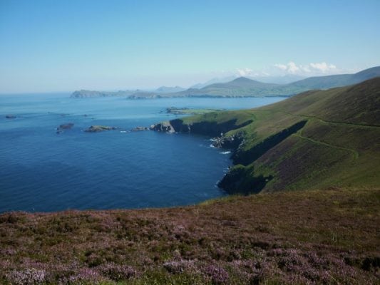
The short loop walk around the Great Blasket Island is an easy to moderate 2.5 hour (6.5 km) walking route along the amzingly scenic tracks on this uninhabited and historic Island at the western end on the Dingle Peninsula, County Kerry in the southwest of Ireland and on the western fringes of Europe. There are also some longer loop walks on the Island and if you have time you should try them.
The Blasket Islands in County Kerry are a group of 6 islands off the west coast of Ireland. The biggest, known as the Great Blasket Island is approximately 6 km and a maximum height of 292 metres at An Cró Mór mountain. The islands were inhabited until 1953 by a completely Irish-speaking population until they were abondened due to safety issues when finally a young Islander died when he couldn't be taken off the island in bad weather. The small fishing community on the island (even at its peak the population was hardly more than 150) mostly lived in primitive cottages perched on the relatively sheltered north-east shore. Despite its close proximity to the mainland the sea and mist can be notoriously dangerous here. The island lies approximately 2 km from the mainland with a ferry service from Dunquin Pier to the Great Blasket Island during summer months (usually €20 per person return).
Use our Map of Ireland and Sat Nav tool to get directions to any of the stage start points and our detailed maps and GPS on our ActiveME App to find and follow the walking route live on screen and keep on track. At all times, our maps and App should be used in conjunction with proper map and compass navigation techniques. Feel free to send us your photos and add you own star rating, comments or suggestions below.
Gallery
The short loop walk around the Great Blasket Island is an easy to moderate 2.5 hour (6.5 km) walking route along the amzingly scenic tracks on this uninhabited and historic Island at the western end on the Dingle Peninsula, County Kerry in the southwest of Ireland and on the western fringes of Europe. There are also some longer loop walks on the Island and if you have time you should try them.
The Blasket Islands in County Kerry are a group of 6 islands off the west coast of Ireland. The biggest, known as the Great Blasket Island is approximately 6 km and a maximum height of 292 metres at An Cró Mór mountain. The islands were inhabited until 1953 by a completely Irish-speaking population until they were abondened due to safety issues when finally a young Islander died when he couldn’t be taken off the island in bad weather. The small fishing community on the island (even at its peak the population was hardly more than 150) mostly lived in primitive cottages perched on the relatively sheltered north-east shore. Despite its close proximity to the mainland the sea and mist can be notoriously dangerous here. The island lies approximately 2 km from the mainland with a ferry service from Dunquin Pier to the Great Blasket Island during summer months (usually €20 per person return).
Use our Map of Ireland and Sat Nav tool to get directions to any of the stage start points and our detailed maps and GPS on our ActiveME App to find and follow the walking route live on screen and keep on track. At all times, our maps and App should be used in conjunction with proper map and compass navigation techniques. Feel free to send us your photos and add you own star rating, comments or suggestions below.


