- Created: September 20, 2015 7:43 pm
- Updated: December 12, 2017 10:58 am
- Distance Instructions
- Distance 0 m
- Time 0 s
- Speed 0.0 km/h
- Min altitude 0 m
- Peak 0 m
- Climb 0 m
- Descent 0 m
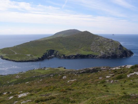
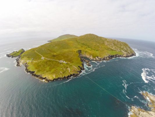
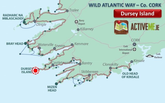
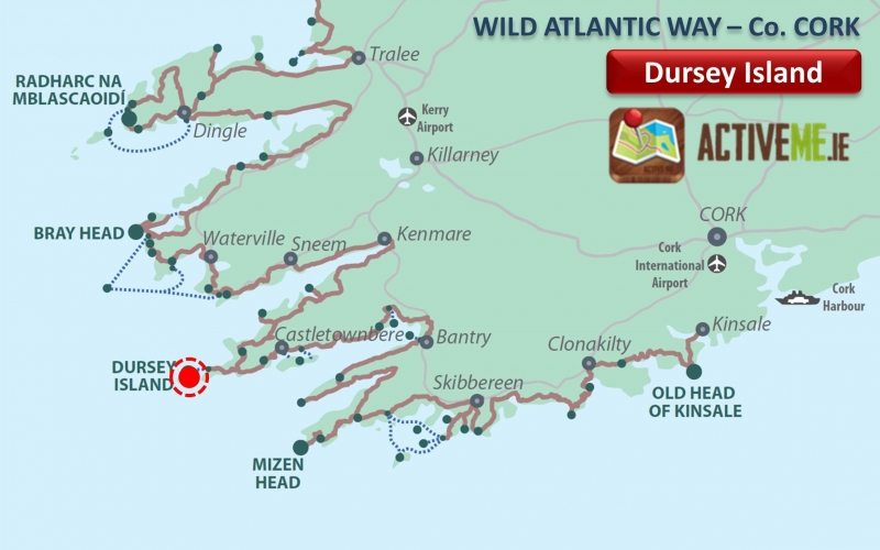
The unique Dursey Island is county Cork’s most westerly-inhabited island and Ireland's only island that is connected to the mainland by cable car, Yes, a cable car!! Located at the southwestern tip of the Beara Peninsula in west Cork and is a Signature Discovery Point on the Wild Atlantic Way scenic coastal drive.
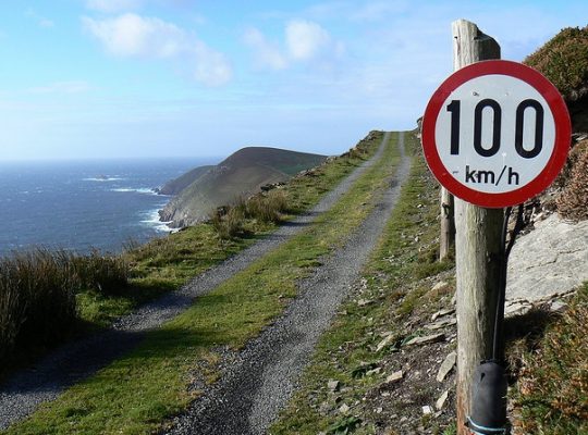
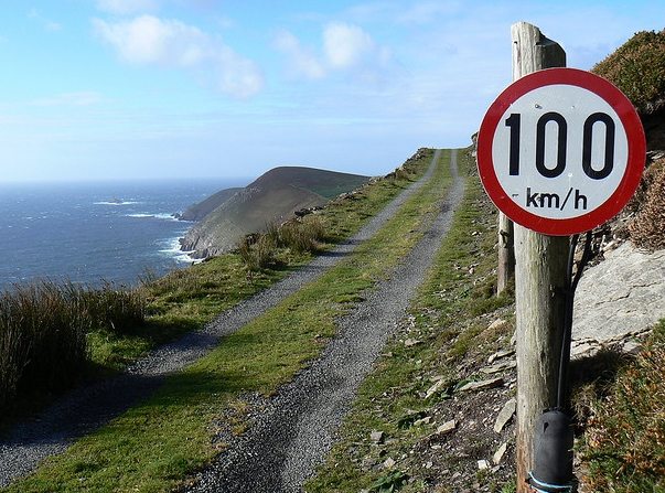
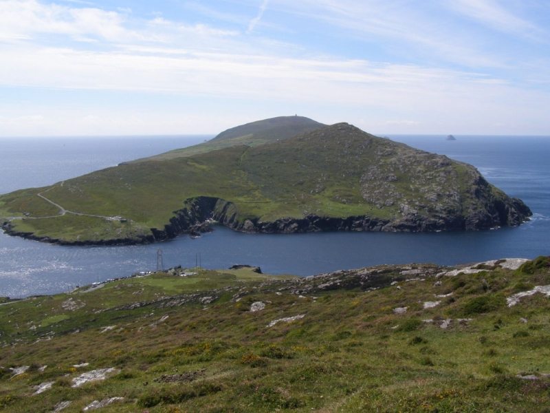 When you arrive, take the picturesque Beara Way walking trail along the warm south facing slopes towards the island’s lighthouse (which dates back to the 1880s) and castle ruins and maybe you can enjoy what’s known as ‘Europe’s last sunset’. Like many areas on Ireland's south west coast, this area enjoys a tropical climate due to the close proximity of the Gulf Stream and the local flora is lush and sometimes exotic.
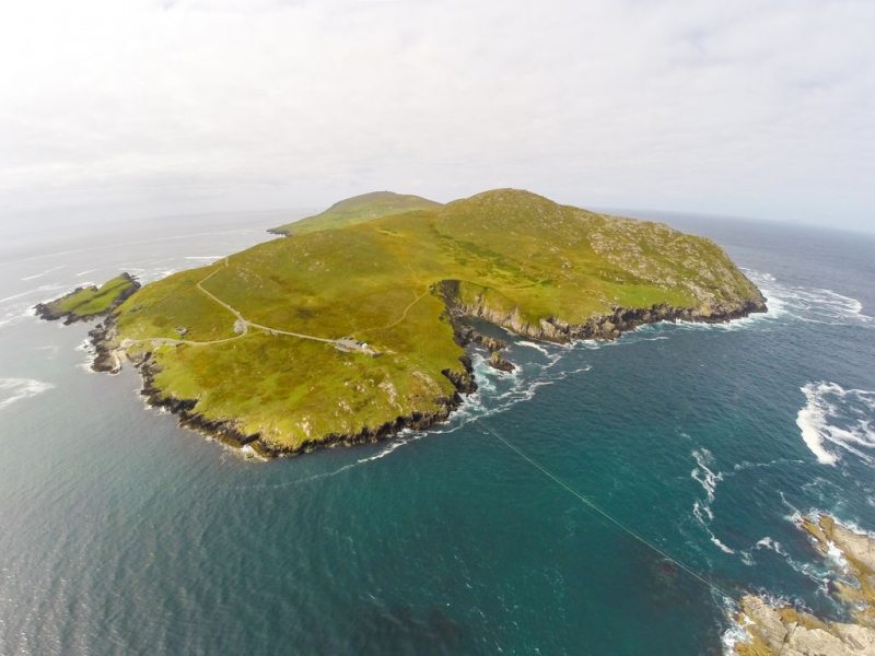 The views from the Dursey include the nearby Scariff and Deenish islands, the mountains of Iveragh, Skellig Michael monastic island to the north and Bull and Cow islands to west. Bull (Calf) island, which now has a lighthouse was said to be doorway to the Otherworld in the past and was known as Tigh Dhoinn, house of darkness, or death. Oileán Baoi (Dursey in Irish) is after a local divinity Baoi, from Irish Folklore and Mythology, who was mother of the land and spirit of the wild. She was a version of the Cailleach Bhéarra (the Hag of Beara), a goddess and wise woman known throughout Ireland and Scotland.
Dursey has rich history and the scene of some barbarous acts of war including the marauding Vikings, who are said to have used the island as a holding station for captives. Pirates who came and destroyed the monastery and more. And finally, the tragic events in 1602 when Queen Elizabeth’s forces aided by an O’Sullivan kinsman from a hostile faction stormed the fort and massacred some 300 local people from the local O'Sullivan Clan including women, children and the elderly, forcing many over the cliffs and into the sea. Dursey Island (Oilian Baoi Bheirre in Irish) was the last post on which the O'Sullivans clan relied and they made their fort a place of refuge for their women and children. Foundations of this O’Sullivan fortress can be seen on Oileán Beag (little island). As a result of this attack, the owner of the fort, Diarmuid of Dursey, joined his nephew, Donal Cam O’Sullivan Beare and one thousand fugitives, on the famous 550km winter-march from West Cork to Breifne, Co. Leitrim with only 35 surviving the harsh journey which included starvations and many battles along the way. The route taken is now commemorated in the Beara-Breifne Way walking trail.
Monks from the nearby Skellig Rock reputedly founded the ancient church of Kilmichael on the island while later, the monastery was said to have been built in the 16th century by a Spanish bishop named Bonaventura which was then demolished by pirates. The signal-tower like many others along Irelands coast was built in the early 19th century in case of Napoleonic invasion. The last fact I will regale to you is that the lookout post (number 32) which still survives on the headland is from the second world war and was one of 83 along Ireland's coast and was a basic GPS system for pilots with large EIRE signs also laid out on the ground.
Dursey has no shops, pubs or restaurants so visitors are advised to bring food and water if they plan to go for a walk. Dolphins and whales are regular visitors to the rich waters that surround Dursey, in addition to a wide range of different types of seabirds and butterflies.
Dursey is the start or end point on the E8 European Long Distance Walking Route from Dursey Island in West Cork, Ireland to Istanbul in Turkey. The Irish section of this route is part of the Beara Way Walking Route and is a moderate to strenuous 12 to 30 day (600 km) walking route from Dublin City to the western most point on Dursey Island.
The unique Dursey Island is county Cork’s most westerly-inhabited island and Ireland’s only island that is connected to the mainland by cable car, Yes, a cable car!! Located at the southwestern tip of the Beara Peninsula in west Cork and is a Signature Discovery Point on the Wild Atlantic Way scenic coastal drive.
 When you arrive, take the picturesque Beara Way walking trail along the warm south facing slopes towards the island’s lighthouse (which dates back to the 1880s) and castle ruins and maybe you can enjoy what’s known as ‘Europe’s last sunset’. Like many areas on Ireland’s south west coast, this area enjoys a tropical climate due to the close proximity of the Gulf Stream and the local flora is lush and sometimes exotic.
 The views from the Dursey include the nearby Scariff and Deenish islands, the mountains of Iveragh, Skellig Michael monastic island to the north and Bull and Cow islands to west. Bull (Calf) island, which now has a lighthouse was said to be doorway to the Otherworld in the past and was known as Tigh Dhoinn, house of darkness, or death. Oileán Baoi (Dursey in Irish) is after a local divinity Baoi, from Irish Folklore and Mythology, who was mother of the land and spirit of the wild. She was a version of the Cailleach Bhéarra (the Hag of Beara), a goddess and wise woman known throughout Ireland and Scotland.

Dursey has rich history and the scene of some barbarous acts of war including the marauding Vikings, who are said to have used the island as a holding station for captives. Pirates who came and destroyed the monastery and more. And finally, the tragic events in 1602 when Queen Elizabeth’s forces aided by an O’Sullivan kinsman from a hostile faction stormed the fort and massacred some 300 local people from the local O’Sullivan Clan including women, children and the elderly, forcing many over the cliffs and into the sea. Dursey Island (Oilian Baoi Bheirre in Irish) was the last post on which the O’Sullivans clan relied and they made their fort a place of refuge for their women and children. Foundations of this O’Sullivan fortress can be seen on Oileán Beag (little island). As a result of this attack, the owner of the fort, Diarmuid of Dursey, joined his nephew, Donal Cam O’Sullivan Beare and one thousand fugitives, on the famous 550km winter-march from West Cork to Breifne, Co. Leitrim with only 35 surviving the harsh journey which included starvations and many battles along the way. The route taken is now commemorated in the Beara-Breifne Way walking trail.
Monks from the nearby Skellig Rock reputedly founded the ancient church of Kilmichael on the island while later, the monastery was said to have been built in the 16th century by a Spanish bishop named Bonaventura which was then demolished by pirates. The signal-tower like many others along Irelands coast was built in the early 19th century in case of Napoleonic invasion. The last fact I will regale to you is that the lookout post (number 32) which still survives on the headland is from the second world war and was one of 83 along Ireland’s coast and was a basic GPS system for pilots with large EIRE signs also laid out on the ground.
Dursey has no shops, pubs or restaurants so visitors are advised to bring food and water if they plan to go for a walk. Dolphins and whales are regular visitors to the rich waters that surround Dursey, in addition to a wide range of different types of seabirds and butterflies.
Dursey is the start or end point on the E8 European Long Distance Walking Route from Dursey Island in West Cork, Ireland to Istanbul in Turkey. The Irish section of this route is part of the Beara Way Walking Route and is a moderate to strenuous 12 to 30 day (600 km) walking route from Dublin City to the western most point on Dursey Island.

