- Created: August 28, 2012 10:33 am
- Updated: December 12, 2017 11:01 am
- Distance Instructions
- Distance 103 km
- Time 0 s
- Speed 0.0 km/h
- Min altitude 23 m
- Peak 115 m
- Climb 313 m
- Descent 295 m
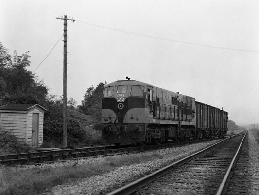
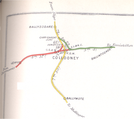
Collooney has a strange railway history. Considering its tiny population it had 3 railway stations between 1895 and 1957 providing access to most of the country by rail. It was served by three railway companies each with a seperate station, the Midland Great Western from Mullingar/Dublin, the Great Southern and Western (GS&WR) from Claremorris/Limerick and the Sligo, Leitrim and Northern Counties (SLNCR) from Manorhamilton/Enniskillen. A section of dismantled railway may have the potential to be developed as a walking/cycle route.
Use our Map of Ireland and Sat Nav tool to get directions to any point on the old line and our detailed maps and GPS on our ActiveME App to find and follow the line live on screen and keep on track.
Gallery
Collooney has a strange railway history. Considering its tiny population it had 3 railway stations between 1895 and 1957 providing access to most of the country by rail. It was served by three railway companies each with a seperate station, the Midland Great Western from Mullingar/Dublin, the Great Southern and Western (GS&WR) from Claremorris/Limerick and the Sligo, Leitrim and Northern Counties (SLNCR) from Manorhamilton/Enniskillen. A section of dismantled railway may have the potential to be developed as a walking/cycle route.
Use our Map of Ireland and Sat Nav tool to get directions to any point on the old line and our detailed maps and GPS on our ActiveME App to find and follow the line live on screen and keep on track.


