- Created: November 12, 2012 11:32 am
- Updated: December 12, 2017 11:00 am
- Distance Instructions
- Distance 23 km
- Time 0 s
- Speed 0.0 km/h
- Min altitude 28 m
- Peak 842 m
- Climb 978 m
- Descent 977 m
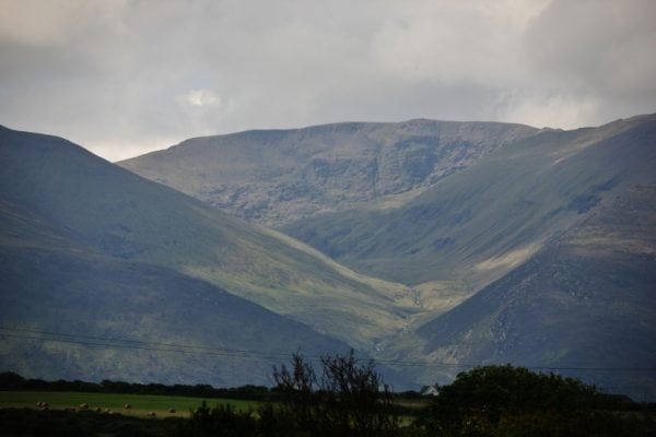
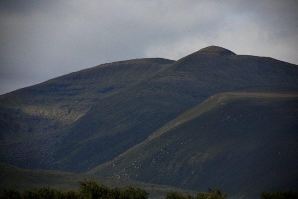
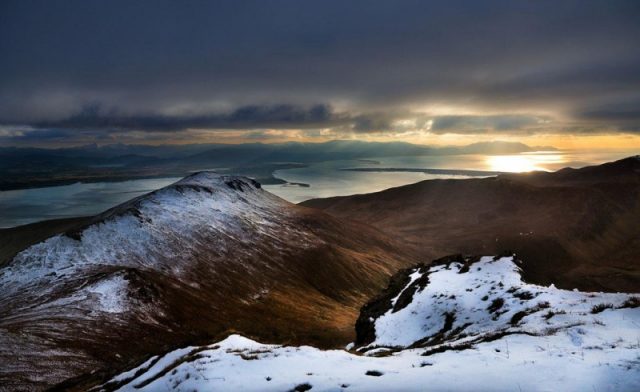
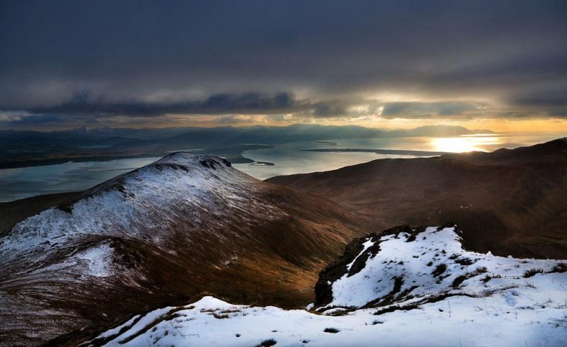
The Curraheen Derrymore Loop Walk is a strenuous 7 to 8 hour loop walking route taking in main peaks of the Slieve Mish Mountains, Kerry, Ireland with great views of Tralee Bay. This walking route visits the main peaks of Baurtragaum (851m) and Caherconree (835m) and the picturesque valley of Derrymore and Curraheen.
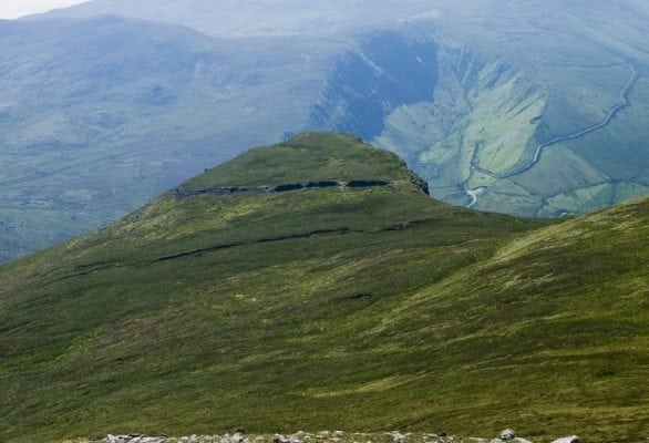
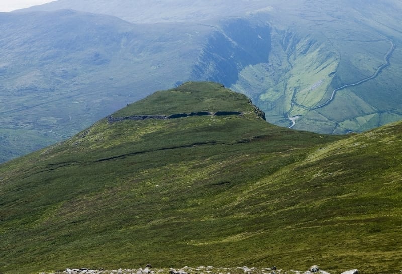
To the south west of Caherconree peak is Caherconree Fort at 683m. It is the highest stone promontory fort in Ireland and is steeped in mythology and folklore. In Irish mythology, the fort is said to have been built by Cú Roí Mac Daire the legendary King of West Munster during the red Branch Era (the early Iron Age) and evil sorcerer. He is said to have had magical powers in many old Irish stories and his name is repeatedly mentioned in Welsh folklore with the likes of Merlin, Camelot and the Round Table and further afield in Belgian folklore. It is said that he was able to make the fort spin around at night to stop any attackers from finding the entrance.
In the story of Aided Con Roí, a king's daughter called Bláthnaid is kidnapped by Cú Roí and taken to the fort. Once there for a time, Bláthnaid flattered Cú Roí by telling him that the construction of the fort was not suitable for one as great as he. So Cú Roí sent his warriors out to gather more stones so that the fort could be enlarged. While the fort was undefended, Bláthnaid signals to Cú Chulainn that the time is right to attack by pouring milk in a stream. Cú Chulainn then attacks the fort killing Cú Roí and rescues his lover Bláthnaid. This stream is now called the Finglas (meaning "the white stream") and its source is close to the remains of the ringfort. There is also a rock feature on the mountain called Fionn MacCool's Chair, which is named after the mythical Irish figure Fionn mac Cumhaill.
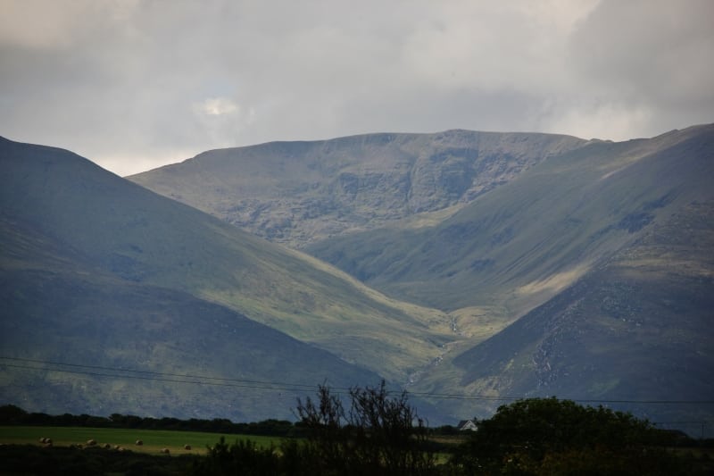
If you look closely at the photograph below, you should be able to see the 3 faces of Cú Roí Mac Daire directly below the summit of Caherconree.
This walk is only a short drive from Tralee and there are also many other shorter walks in the area. Use our Map of Ireland and Sat Nav tool to get directions to the start point of this walk and use our detailed map and GPS on our ActiveME App to find and follow the walking route and keep on track.
Gallery
The Curraheen Derrymore Loop Walk is a strenuous 7 to 8 hour loop walking route taking in main peaks of the Slieve Mish Mountains, Kerry, Ireland with great views of Tralee Bay. This walking route visits the main peaks of Baurtragaum (851m) and Caherconree (835m) and the picturesque valley of Derrymore and Curraheen.

To the south west of Caherconree peak is Caherconree Fort at 683m. It is the highest stone promontory fort in Ireland and is steeped in mythology and folklore. In Irish mythology, the fort is said to have been built by Cú Roí Mac Daire the legendary King of West Munster during the red Branch Era (the early Iron Age) and evil sorcerer. He is said to have had magical powers in many old Irish stories and his name is repeatedly mentioned in Welsh folklore with the likes of Merlin, Camelot and the Round Table and further afield in Belgian folklore. It is said that he was able to make the fort spin around at night to stop any attackers from finding the entrance.

In the story of Aided Con Roí, a king’s daughter called Bláthnaid is kidnapped by Cú Roí and taken to the fort. Once there for a time, Bláthnaid flattered Cú Roí by telling him that the construction of the fort was not suitable for one as great as he. So Cú Roí sent his warriors out to gather more stones so that the fort could be enlarged. While the fort was undefended, Bláthnaid signals to Cú Chulainn that the time is right to attack by pouring milk in a stream. Cú Chulainn then attacks the fort killing Cú Roí and rescues his lover Bláthnaid. This stream is now called the Finglas (meaning “the white stream”) and its source is close to the remains of the ringfort. There is also a rock feature on the mountain called Fionn MacCool’s Chair, which is named after the mythical Irish figure Fionn mac Cumhaill.

If you look closely at the photograph below, you should be able to see the 3 faces of Cú Roí Mac Daire directly below the summit of Caherconree.

This walk is only a short drive from Tralee and there are also many other shorter walks in the area. Use our Map of Ireland and Sat Nav tool to get directions to the start point of this walk and use our detailed map and GPS on our ActiveME App to find and follow the walking route and keep on track.

