- Created: November 10, 2013 8:54 am
- Updated: December 12, 2017 10:59 am
- Distance Instructions
- Distance 9 km
- Time 0 s
- Speed 0.0 km/h
- Min altitude 76 m
- Peak 810 m
- Climb 606 m
- Descent 741 m
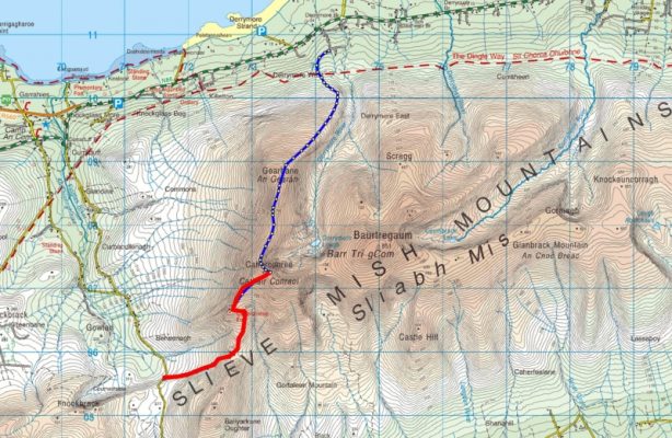
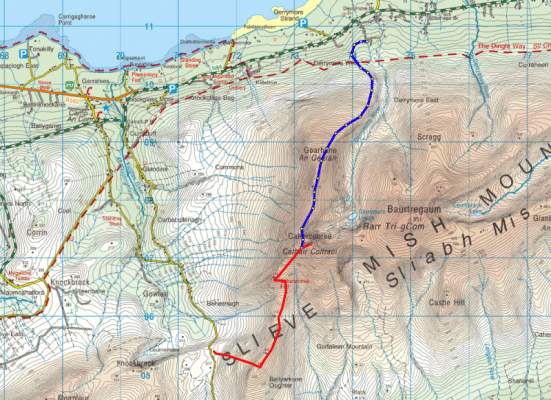
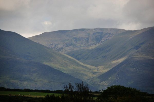
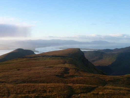
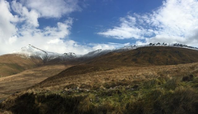
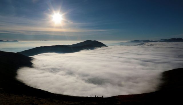
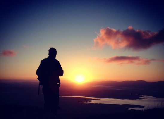
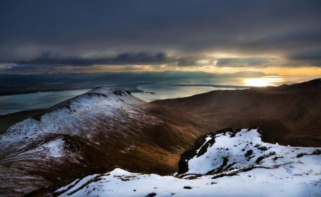
The ancient and magical trail to Caherconree Stone Fort and Caherconree Mountain (835m) is a moderate 6km (3hr) return trip to the summit, a 4km (2hr) return trip to the fort or a 7.0km (3.5 hour) one-way walking route on the Slieve Mish Mountains in Co. Kerry. Located only 10mins from Tralee in the southwest of Ireland, Caherconree has great views of Tralee Bay and one of the best walking routes on the Wild Atlantic Way. Although relatively short mountain walks, Caherconree is one of the most rewarding, magical and life changing walks in Ireland and is a common midsummer sunrise walk to celebrate the pagan Summer Solstice festival on June 21st. The route starts or ends on the steep scenic mountain road known as Bóthar na gCloch or 'Road of the stones' south of Camp where roadside parking is available and signs show you the trail head. Follow the route marker posts to the summit and if you want to avoid retracing your steps and enjoy great views of the Wild Atlantic Way, continue along the mountain ridge from the summit all the way to An Géarán Mountain (792m) before descending to Derrymore, where you can park another car as shown in route map below. Take the route with you on our free ActiveMe App. Photos by Valerie O'Sullivan and Brian Coakley.
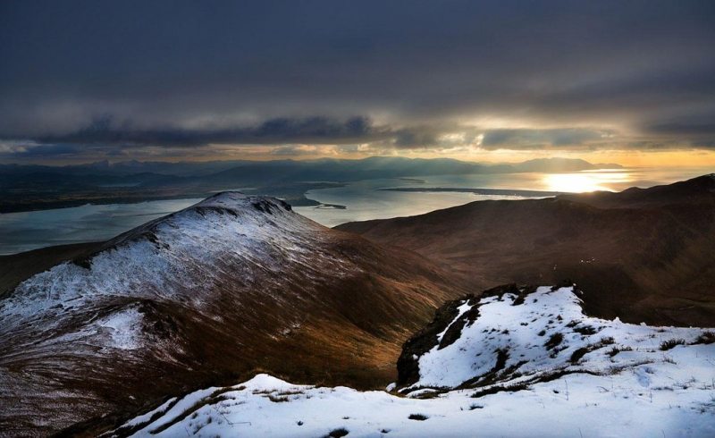
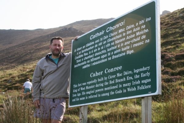
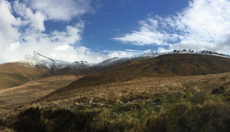
Caherconree mountain (825m) in Irish is Caher Conri, The Stone Fort of Cú Roí. To the south of the summit is the actual ancient Caherconree Fort at 683m which overlooks another ancient mountain road known as Bóthar na gCloch or 'Road of the stones'. It is the highest stone promontory fort in Ireland and is steeped in mythology and folklore. All that remains today of the fort is a tumbling stone wall 107m (350ft) long, 4m (14ft) thick and 3m (10ft) high that cuts off a narrow triangle of land 683m (2,250 ft) above sea level as shown in the photograph. With the entrance protected by this wall and sheer cliffs protecting the other two sides, this small triangular fort, around 2 acres in size high up on a remote mountain in west Kerry must have been something to behold in its day and almost impregnable. Views from the fort can extend nearly 100km on a good day and it overlooks a huge swaths of Co. Kerry from the MacGillycuddy's Reeks to the south, the Iveragh Peninsula, the Ring of Kerry and Dingle Bay to the southwest, the Dingle Peninsula and Brandon Mountains to west, the Maharees, Tralee and Brandon Bays and the longest beach in Ireland to the northwest and Tralee and North Kerry to the North.
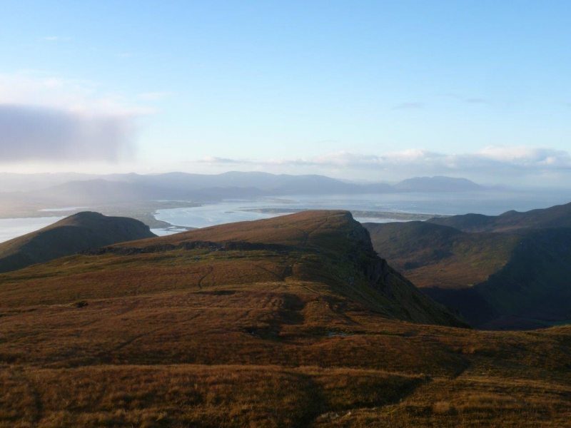
Caherconree itself is one of the oldest place names found in Ireland and Caherconree Fort was named as one of the 3 oldest buildings in the land in the 'Triads of Ireland ' text written between the 9th -14th centuries. A battle was also said to have taken place here in 637 in the The Battle of Magh Rath tale from the 12th century.
 In Irish mythology, the fort is said to have been built by Cú Roí Mac Daire, the legendary evil sorcerer and King of West Munster during the era of the Red Branch Nights of Ulster, the early Iron Age 500BC to 100BC. He is said to have been a Godlike shapeshifter or Demigod with magical powers and is known to have changed into a giant, a dog or with an oak tree growing from his back. His name is contained in many old Irish stories and is also repeatedly mentioned in Welsh folklore with the likes of Merlin, Camelot and the Round Table and further afield in Belgian folklore as far back as the 11th century. Even when overseas, it is said that he was able to make the fort spin around at night to stop any attackers from finding the entrance.
Once there for a time, Bláthnaid flattered Cú Roí by telling him that the construction of the fort was not suitable for one as great as he. So Cú Roí sent his warriors out to gather more stones so that the fort could be enlarged. While the fort was undefended, Bláthnaid signals to Cú Chulainn that the time is right to attack by pouring milk in a stream. Cú Chulainn then attacks the fort, killing Cú Roí and his army and rescues his lover Bláthnaid. This stream is now called the Finglas or An fhionnghlaise (meaning 'the white stream or brook') and its source is close to the remains of the fort. However, it was not happy ever after. Years later, Cú Roí’s poet Ferchertne, who survived the attack on Caherconree, met Bláthnaid along a mountain path. Grabbing her, he then jumped off the cliff killing them both and giving Cú Roí revenge from the grave. They were buried at the foot of the cliff, at a place still known as Feart Bláthnat agus Feirceitne ('The Mound of Blaithne and Feirceitne'). Here is a great page about Caherconree by Voices from the Dawn
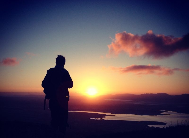
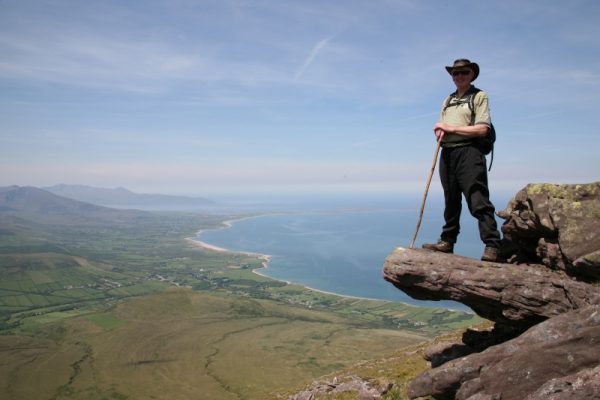
There are also rock features on the mountain called Fionn MacCool’s Chair and Table, named after the mythical Irish Hero Fionn mac Cumhaill from a later era of Irish Mythology. Fionn MacCumhaills chair is a great photo oppertunity with spectacular views of Tralee and Brandon Bay as shown in the photo below.
Follow in the footsteps of Cú Roí Mac Daire, the ancient King of West Munster and Cú Chulainn, the ancient hero of Irish Mythology. If you look closely at the photograph below, you should be able to see the 3 faces of Cú Roí Mac Daire directly below the summit of Caherconree.
This walk is only a short 10min drive from Tralee and there are also many other shorter and longer walks in the area.
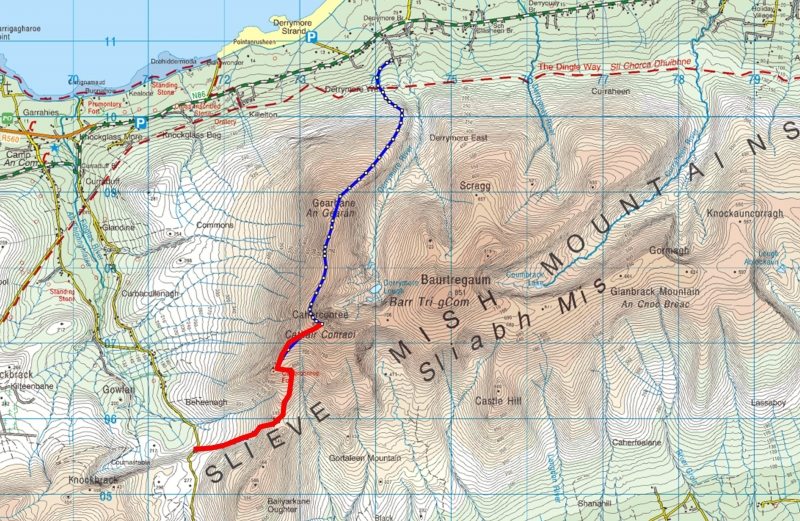
Use our Map of Ireland and Sat Nav tool to get directions to the start point of this walk and use our detailed map and GPS on our ActiveME App to find and follow the walking route and keep on track in conjunction with proper map and compass navigation techniques.
Weather in Ireland and especially on mountains is nothing but unpredictable so be sure to check the weather, as the top of Caherconree can disappear into the clouds in seconds with visibility down to below 30ft and few landmarks available to get your bearings. The Met Eireann 5-Day Forecast is very handy and is unusually accurate in the short term!!! If the weather is bad, don't ever be afraid to cancel your mountain walk for something lower like the great beach walk nearby. There are plenty of other routes to suit beginners to advanced walkers in the area, so please find a route that is right for you or your group. Plan your walk by checking the weather, sunrise sunset times and our hiking checklist on our website here. Please remember that you are only as fast as the slowest member of your group!
The ancient and magical trail to Caherconree Stone Fort and Caherconree Mountain (835m) is a moderate 6km (3hr) return trip to the summit, a 4km (2hr) return trip to the fort or a 7.0km (3.5 hour) one-way walking route on the Slieve Mish Mountains in Co. Kerry. Located only 10mins from Tralee in the southwest of Ireland, Caherconree has great views of Tralee Bay and one of the best walking routes on the Wild Atlantic Way. Although relatively short mountain walks, Caherconree is one of the most rewarding, magical and life changing walks in Ireland and is a common midsummer sunrise walk to celebrate the pagan Summer Solstice festival on June 21st. The route starts or ends on the steep scenic mountain road known as Bóthar na gCloch or ‘Road of the stones’ south of Camp where roadside parking is available and signs show you the trail head. Follow the route marker posts to the summit and if you want to avoid retracing your steps and enjoy great views of the Wild Atlantic Way, continue along the mountain ridge from the summit all the way to An Géarán Mountain (792m) before descending to Derrymore, where you can park another car as shown in route map below. Take the route with you on our free ActiveMe App. Photos by Valerie O’Sullivan and Brian Coakley.

Caherconree mountain (825m) in Irish is Caher Conri, The Stone Fort of Cú Roí. To the south of the summit is the actual ancient Caherconree Fort at 683m which overlooks another ancient mountain road known as Bóthar na gCloch or ‘Road of the stones’. It is the highest stone promontory fort in Ireland and is steeped in mythology and folklore. All that remains today of the fort is a tumbling stone wall 107m (350ft) long, 4m (14ft) thick and 3m (10ft) high that cuts off a narrow triangle of land 683m (2,250 ft) above sea level as shown in the photograph. With the entrance protected by this wall and sheer cliffs protecting the other two sides, this small triangular fort, around 2 acres in size high up on a remote mountain in west Kerry must have been something to behold in its day and almost impregnable. Views from the fort can extend nearly 100km on a good day and it overlooks a huge swaths of Co. Kerry from the MacGillycuddy’s Reeks to the south, the Iveragh Peninsula, the Ring of Kerry and Dingle Bay to the southwest, the Dingle Peninsula and Brandon Mountains to west, the Maharees, Tralee and Brandon Bays and the longest beach in Ireland to the northwest and Tralee and North Kerry to the North.

Caherconree itself is one of the oldest place names found in Ireland and Caherconree Fort was named as one of the 3 oldest buildings in the land in the ‘Triads of Ireland ‘ text written between the 9th -14th centuries. A battle was also said to have taken place here in 637 in the The Battle of Magh Rath tale from the 12th century.
 In Irish mythology, the fort is said to have been built by Cú Roí Mac Daire, the legendary evil sorcerer and King of West Munster during the era of the Red Branch Nights of Ulster, the early Iron Age 500BC to 100BC. He is said to have been a Godlike shapeshifter or Demigod with magical powers and is known to have changed into a giant, a dog or with an oak tree growing from his back. His name is contained in many old Irish stories and is also repeatedly mentioned in Welsh folklore with the likes of Merlin, Camelot and the Round Table and further afield in Belgian folklore as far back as the 11th century. Even when overseas, it is said that he was able to make the fort spin around at night to stop any attackers from finding the entrance.

Once there for a time, Bláthnaid flattered Cú Roí by telling him that the construction of the fort was not suitable for one as great as he. So Cú Roí sent his warriors out to gather more stones so that the fort could be enlarged. While the fort was undefended, Bláthnaid signals to Cú Chulainn that the time is right to attack by pouring milk in a stream. Cú Chulainn then attacks the fort, killing Cú Roí and his army and rescues his lover Bláthnaid. This stream is now called the Finglas or An fhionnghlaise (meaning ‘the white stream or brook’) and its source is close to the remains of the fort. However, it was not happy ever after. Years later, Cú Roí’s poet Ferchertne, who survived the attack on Caherconree, met Bláthnaid along a mountain path. Grabbing her, he then jumped off the cliff killing them both and giving Cú Roí revenge from the grave. They were buried at the foot of the cliff, at a place still known as Feart Bláthnat agus Feirceitne (‘The Mound of Blaithne and Feirceitne’). Here is a great page about Caherconree by Voices from the Dawn

There are also rock features on the mountain called Fionn MacCool’s Chair and Table, named after the mythical Irish Hero Fionn mac Cumhaill from a later era of Irish Mythology. Fionn MacCumhaills chair is a great photo oppertunity with spectacular views of Tralee and Brandon Bay as shown in the photo below.
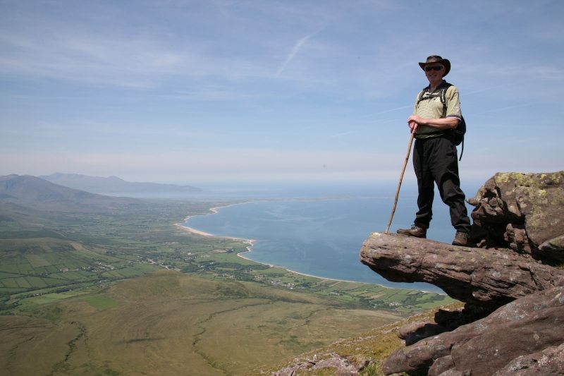
Follow in the footsteps of Cú Roí Mac Daire, the ancient King of West Munster and Cú Chulainn, the ancient hero of Irish Mythology. If you look closely at the photograph below, you should be able to see the 3 faces of Cú Roí Mac Daire directly below the summit of Caherconree.
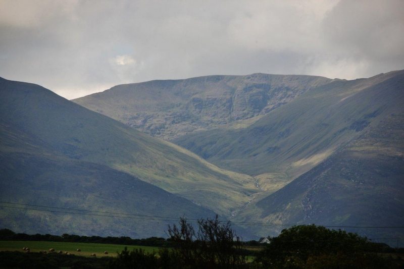
This walk is only a short 10min drive from Tralee and there are also many other shorter and longer walks in the area.

Use our Map of Ireland and Sat Nav tool to get directions to the start point of this walk and use our detailed map and GPS on our ActiveME App to find and follow the walking route and keep on track in conjunction with proper map and compass navigation techniques.
Weather in Ireland and especially on mountains is nothing but unpredictable so be sure to check the weather, as the top of Caherconree can disappear into the clouds in seconds with visibility down to below 30ft and few landmarks available to get your bearings. The Met Eireann 5-Day Forecast is very handy and is unusually accurate in the short term!!! If the weather is bad, don’t ever be afraid to cancel your mountain walk for something lower like the great beach walk nearby. There are plenty of other routes to suit beginners to advanced walkers in the area, so please find a route that is right for you or your group. Plan your walk by checking the weather, sunrise sunset times and our hiking checklist on our website here. Please remember that you are only as fast as the slowest member of your group!

