- Created: February 28, 2012 11:32 am
- Updated: December 12, 2017 11:02 am
- Distance Instructions
- Distance 18 km
- Time 0 s
- Speed 0.0 km/h
- Min altitude 1 m
- Peak 387 m
- Climb 485 m
- Descent 485 m
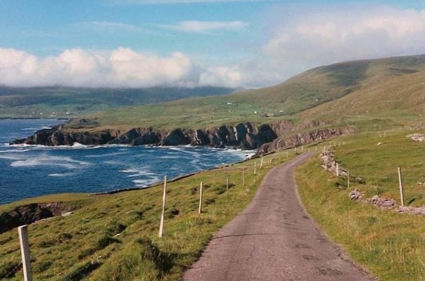
Ballinskelligs to Bolus Mountain Loop is a moderate to strenuous 5 to 6 hour (14.5 km) walking route from Ballingskelligs with its spectacular Blue Flag beach to the summit of Bolus mountain with stunning 360 degree views of Iveragh Peninsula and the Skelligs Islands in county Kerry in the sout west of Ireland.
There are plenty of routes available, so find a route that is right for you or your group. Plan your walk by estimating you walking time, checking the weather and the sunrise sunset times on our website https://www.activeme.ie/useful-info/planning-a-trip/ and please remember you are only as fast as the slowest member of your group!
Use our Map of Ireland and Sat Nav tool to get directions to any of the stage start points and our detailed maps and GPS on our ActiveME iPhone and Android App to find and follow the walking route live on screen and keep on track. At all times, our maps and App should be used in conjunction with proper map and compass navigation techniques. Feel free to send us your photos and add you own star rating, comments or suggestions below.
Gallery
Ballinskelligs to Bolus Mountain Loop is a moderate to strenuous 5 to 6 hour (14.5 km) walking route from Ballingskelligs with its spectacular Blue Flag beach to the summit of Bolus mountain with stunning 360 degree views of Iveragh Peninsula and the Skelligs Islands in county Kerry in the sout west of Ireland.
There are plenty of routes available, so find a route that is right for you or your group. Plan your walk by estimating you walking time, checking the weather and the sunrise sunset times on our website https://www.activeme.ie/useful-info/planning-a-trip/ and please remember you are only as fast as the slowest member of your group!
Use our Map of Ireland and Sat Nav tool to get directions to any of the stage start points and our detailed maps and GPS on our ActiveME iPhone and Android App to find and follow the walking route live on screen and keep on track. At all times, our maps and App should be used in conjunction with proper map and compass navigation techniques. Feel free to send us your photos and add you own star rating, comments or suggestions below.


