- Created: January 28, 2013 11:32 am
- Updated: December 12, 2017 11:00 am
- Distance Instructions
- Distance 14 km
- Time 0 s
- Speed 0.0 km/h
- Min altitude 152 m
- Peak 925 m
- Climb 879 m
- Descent 878 m
The loop walk on the Eastern MacGillycuddy Reeks going up Zig-Zag and down The Bone is a moderate 4 hour (14 km) walking route on Irelands highest mountains near the picturesque town of Killarney, County Kerry. You can also do this route in reverse as they are some of the safest ascents and decents from the Reeks.
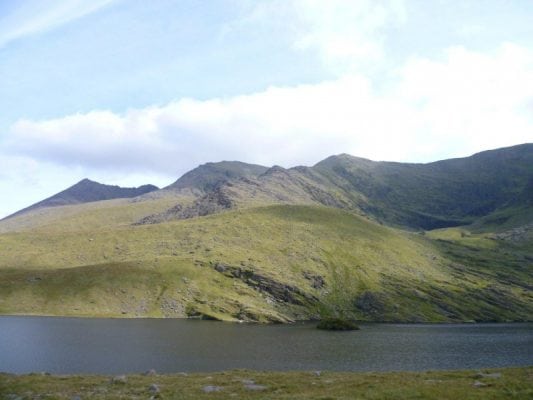
From Cronins yard follow the Carrauntoohil path into the Hags Glen, passed Lough Gouragh on your right and Lough Callee on your left until you approach the foot of the obvious Devils Ladder route straight ahead of you. The start of the Zig-Zags is on your left just before you reach the Devils Ladder. In the past, the start of the Zig Zag route was sometimes difficult to find. However, with erosion on the Devils Ladder, the Zig-Zag route has beome more popular making it easier to find and follow as a more obvious path is worn in. This is both a good and a bad thing.
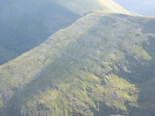
Once you ascend the Zig-Zags, head east following the obvious ridge path taking in the summits of Cnoc na Tionne East (834m), Cnoc an Chuillinn (958m), Cnoc an Chuillinn East (926m) and lastly Máolan Buí (973m - Irelands 6th highest mountain). From here you decend The Bone with some nice scrambling here and there and finally head across the sometimes boggy land and finish at Cronins Yard.
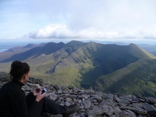
It is recommended to take at one of these summits to take in the amazing scenery and great 360 degree views of Killarney National Park, the Black Valley, Kenmare Bay, Iveragh Peninsula, Carrauntoohil, the Dingle Peninsula and off towards north Kerry. Please remember that there isn’t much shelter to be had on the Eastern Reeks so if its windy and cold you may want to wait for lunch until you can find some.
Although you don't summit Carrauntoohil Mountain (1,040m) on this route it is still one of the more interesting and varied walks on the Reeks, with some nice scrambing required on The Bone, great views and if you have the time and energy you can always try Carrauntoohil (1,040m) on this loop but allow at least an extra 1 hour for this after you climb the Zig-Zags.
Use our Map of Ireland and Sat Nav tool to get directions to the start point and our detailed maps and GPS on our ActiveME iPhone App and Android App to find and follow the walking route live on screen and keep on track. At all times, our maps and App should be used in conjunction with proper map and compass navigation techniques. Feel free to send us your photos and add you own star rating, comments or suggestions below.
Gallery
The loop walk on the Eastern MacGillycuddy Reeks going up Zig-Zag and down The Bone is a moderate 4 hour (14 km) walking route on Irelands highest mountains near the picturesque town of Killarney, County Kerry. You can also do this route in reverse as they are some of the safest ascents and decents from the Reeks.
From Cronins yard follow the Carrauntoohil path into the Hags Glen, passed Lough Gouragh on your right and Lough Callee on your left until you approach the foot of the obvious Devils Ladder route straight ahead of you. The start of the Zig-Zags is on your left just before you reach the Devils Ladder. In the past, the start of the Zig Zag route was sometimes difficult to find. However, with erosion on the Devils Ladder, the Zig-Zag route has beome more popular making it easier to find and follow as a more obvious path is worn in. This is both a good and a bad thing.
Once you ascend the Zig-Zags, head east following the obvious ridge path taking in the summits of Cnoc na Tionne East (834m), Cnoc an Chuillinn (958m), Cnoc an Chuillinn East (926m) and lastly Máolan Buí (973m – Irelands 6th highest mountain). From here you decend The Bone with some nice scrambling here and there and finally head across the sometimes boggy land and finish at Cronins Yard.
It is recommended to take at one of these summits to take in the amazing scenery and great 360 degree views of Killarney National Park, the Black Valley, Kenmare Bay, Iveragh Peninsula, Carrauntoohil, the Dingle Peninsula and off towards north Kerry. Please remember that there isn’t much shelter to be had on the Eastern Reeks so if its windy and cold you may want to wait for lunch until you can find some.
Although you don’t summit Carrauntoohil Mountain (1,040m) on this route it is still one of the more interesting and varied walks on the Reeks, with some nice scrambing required on The Bone, great views and if you have the time and energy you can always try Carrauntoohil (1,040m) on this loop but allow at least an extra 1 hour for this after you climb the Zig-Zags.
Use our Map of Ireland and Sat Nav tool to get directions to the start point and our detailed maps and GPS on our ActiveME iPhone App and Android App to find and follow the walking route live on screen and keep on track. At all times, our maps and App should be used in conjunction with proper map and compass navigation techniques. Feel free to send us your photos and add you own star rating, comments or suggestions below.


