- Created: August 28, 2012 10:32 am
- Updated: December 12, 2017 11:02 am
- Distance Instructions
- Distance 76 km
- Time 0 s
- Speed 0.0 km/h
- Min altitude 27 m
- Peak 610 m
- Climb 1803 m
- Descent 1804 m
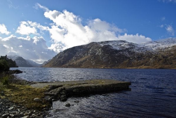
Glenveagh National Park lies in the heart of the Derryveagh Mountains in the north-west of Co. Donegal, Ireland. It is a remote and hauntingly beautiful wilderness of rugged mountains and pristine lakes. The Park is over 16,000 hectares and consists of three areas. The largest of these is the former Glenveagh Estate, including most of the Derryveagh Mountains. To the west are the quartzite hills around Crocknafarragh and to the south, the peatlands of Lough Barra bog, Meenachullion and Crockastoller.
Glenveagh and Killarney National Park have reintroduced Golden Eagles which were originally native to both areas. The park has a wide range of breeding birdlife, as well as red deer, foxes, badgers, otters, goats and mountain sheep. It is therefore a great spot for viewing wildlife, bird watching and walking with several dozen hiking routes throughout the park.
Glenveagh castle and its well maintaned and exotic gardens over Lough Veagh were built in the 19th century by Irish Amercian John George Adair. He was born in Laois but made his money in the United States and built his castle to Belmoral Castle in Scotland. It passed to various owners and in 1975 was sold to the government to create the National Park.
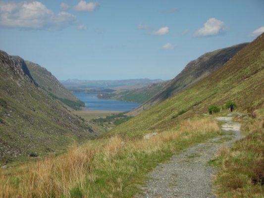
The photo below shows the view of the Upper Glenveagh valley, with Lough Beagh and Glenveagh Castle in the distance. With Farscallop mountain slopes on the right, running down to the valley floor. This path from the R254 road, is known as the "Back entrance to Glenveagh".
Use our Map of Ireland and Sat Nav tool to get directions to any of the stage start points and our detailed maps and GPS on our ActiveME App to find and follow the walking route live on screen and keep on track
Gallery
Glenveagh National Park lies in the heart of the Derryveagh Mountains in the north-west of Co. Donegal, Ireland. It is a remote and hauntingly beautiful wilderness of rugged mountains and pristine lakes. The Park is over 16,000 hectares and consists of three areas. The largest of these is the former Glenveagh Estate, including most of the Derryveagh Mountains. To the west are the quartzite hills around Crocknafarragh and to the south, the peatlands of Lough Barra bog, Meenachullion and Crockastoller.
Glenveagh and Killarney National Park have reintroduced Golden Eagles which were originally native to both areas. The park has a wide range of breeding birdlife, as well as red deer, foxes, badgers, otters, goats and mountain sheep. It is therefore a great spot for viewing wildlife, bird watching and walking with several dozen hiking routes throughout the park.
Glenveagh castle and its well maintaned and exotic gardens over Lough Veagh were built in the 19th century by Irish Amercian John George Adair. He was born in Laois but made his money in the United States and built his castle to Belmoral Castle in Scotland. It passed to various owners and in 1975 was sold to the government to create the National Park.
The photo below shows the view of the Upper Glenveagh valley, with Lough Beagh and Glenveagh Castle in the distance. With Farscallop mountain slopes on the right, running down to the valley floor. This path from the R254 road, is known as the “Back entrance to Glenveagh”.
Use our Map of Ireland and Sat Nav tool to get directions to any of the stage start points and our detailed maps and GPS on our ActiveME App to find and follow the walking route live on screen and keep on track


